A key York route closes today (Friday) for the weekend to allow a new bridge to be winched into place.
As YorkMix reported last week, the bridge at Water End is being placed over the railway line as part of the York Central development.
It means Water End will be shut from tonight till Sunday night. An update has now been released by contractors John Sisk & Son about the project.
What is the bridge for?
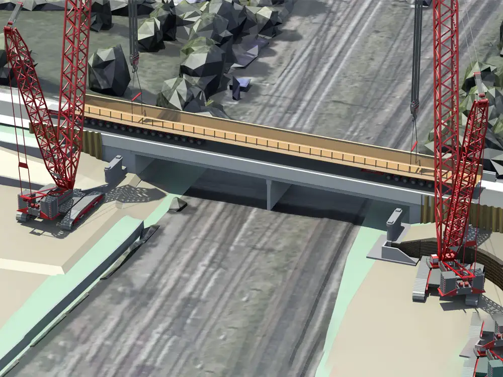
This is one of two bridges that are part of the York Central project. This one is the pedestrian and cycle bridge that will run alongside the existing Severus Bridge.
Moving non-motorised users onto a separate bridge will allow for the necessary lane widening to take place on the road bridge, at a later phase of the project
Road closure
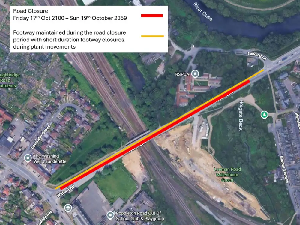
Water End will be closed from the junction at Boroughbridge Road to just before the Salisbury Terrace Junction from
- 9pm today (Friday 17 October)
- until 11.59pm Sunday (19 October).
There will be no access from the A19 (Clifton Green) to the A59 (from Boroughbridge Road) all weekend.
Those using the A19 will still be able to access Salisbury Road to get to the city centre.
The bridge can only be lifted into place when Sisk takes possession of the railway line, which is granted from 1am to 6am Saturday night into Sunday morning.
Bridge location
A spokesperson said: “We do not anticipate considerable noise during this shift, but you might hear the vehicles moving and the sound of the bridge as it is placed on the abutments.
“With this kind of lift, we might be restricted by the weather. If wind speeds are too high, we will not be able to complete this activity.”
Diversion route
For residents of Leeman Road Island area, travelling to the city centre, please continue to use the new spine road, Park Street and Cinder Street. To access the A59, please follow this route and use the diversion down Station Road
For Holgate residents, please access the city centre via the A59. To access Leeman Road or Leeman Road Island properties, please follow the new spine road.
Bridge facts
The bridge …
• Weighs 321 tons – this is the same as around 64 male elephants.
• Is 76 metres long – which is as long as seven double decker buses
• And 7.5 metres wide – if you had size 6 feet, and walked heel to toe, it would take you about 30 steps to get from one side to the other.
Replacement bus service
The contractors have organised a replacement bus service for residents of Leeman Road Island area – the bus service will mimic the existing timetable and will serve the following stops.
10S Clifford Street to Kingsland Terrace
Clifford Street > Bridge Street > Micklegate > George Hudson Street > Rougier Street > Station Road> Station Avenue > Station Road > Museum Street > St Leonards Place > Bootham > Clifton > Clifton Green > Water End > Salisbury Road > Kingsland Terrace
10S Kingsland Terrace to Clifford Street
Kingsland Terrace > Leeman Road > Loverose Way > Park Street > Cinder Street > Leeman Road >Station Rise > Station Avenue > Rougier Street > George Hudson Street > Micklegate > Skeldergate > Skeldergate Bridge > Tower Street > Clifford Street
For more information on diversions and bus routes, please contact John Sisk & Son by email at yorkcentral@sisk.co.uk.